Thursday, August 11, 2011

First Flight and Home

The plans were set for a quick turn and burn to KFFA, First Flight, the meca of aviation, and returning to home base.  08Romeo was fueled to the top and ready to fly and Mike was already flowing through the pre-flight as I strolled in.  I had left work and forgot to change so when I pulled up to the airport I figured I would change in the bathroom at Red Eagle.  Of course with my timing the bathroom was occupied so I decided to make the quick change in the SUV.  Why do I add this you wonder, well, it's been a good many years since I had to get dressed in a vehicle and somehow it's just not as roomy as one needs it to be.  Ok, enough of painting that picture in everyones mind.
I emerged from the phone booth cape securely....oh wait, wrong story.  I got out of the SUV and with flight bag in hand entered my double secret access code and entered the ramp area.  08Romeo was just about ready to go except for a problem with the garmin 496 not acquiring information.  Mike did an online reset with his iPad and within fifteen minutes we were once again looking at wx information.

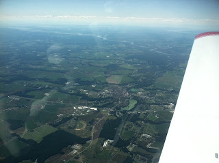
I picked up our clearance to First Flight; DQO ENO V29 SBY V1 CCV ORF ECG NORTN.  We climbed out of Wilmington heavy with fuel and 08Romeo made her way at 500 fpm to eight thousand.  Temps were cool at altitude and Mike had us following our course.  I handled communications and took pictures taking advantage of the opportunity to just enjoy the view.
Delaware Bay off Left wing
Chesapeake Bay off right wing
Dover Downs
Crissfield
Philly handed us off to Dover and Dover to Washington Center. Washington gave us an early direct turn to KFFA just north of  the JAMIE intersection which tracked us east of Fisherman's Island, VA and had us pass over the Bays; Hog Island, Outlet and South. We crossed the mouth of the Chesapeake Bay and had a nice view of the Bay Bridge tunnel and the tankers lined up and waiting to deliver their goods. In the distance we could see the thick smoke from the TFR south of Norfolk climbing and the smoke trails blowing towards the ocean.  A quick reality check as Washington hands us off to Oceania approach and they call out a pair of F-18's headed northbound at our two o'clock. I have the traffic, awesome sight to see as they flew tucked in together in formation passing almost a thousand feet below us.  Mike had to bring me back online so I could focus, I just never get tired of watching military aircraft fly by.
Tangier Island
Cape Charles and across the Chesapeake
outlet bay and fisherman's island
about to cross the mouth of the bay
Fire TFR (red box)
Back Bay refuge south of Virginia beach
We decided to ask for a closer route along the shoreline and once the jets had passed our request was granted. We also got a descent to three thousand and cleared some of the thick smelly smoke we had flew threw. Approach turned us back over to Washington center and they held us until we were turned loose to call on unicom for First Flight.  I called out our position and intentions for pattern entry but called the wrong runway...duh! A saratoga inbound chimed in and corrected me as I responded with my correction and a thanks. I started to laugh since he would see Mike getting out of the left seat when he landed just after us....hehehehe...I'm still cracking up.
Abemarle Sound covered in smoke
smoke clouds
Mike unloaded his gear and introduced me to his family, nice to meet his brother and his Bride. We chatted for a bit then I wanted to get back in the air.  I should have listened to Mikes advice and pick up the clearance in the air but instead called the 800 Clearance Delivery number. After getting disconnected once I finally made contact and got the info.  I taxied out and added a notch of flaps just to be safe for my departure.  I was in the air quickly and with positive climb retracted the flaps.  I made a last call on unicom then switched to approach.  Hmmm, no answer.  I climb a bit more and call again, still no answer.  I double check my clearance and I have the correct frequency dialed in, still no answer.  I flip my knee board sheet and look up our last frequency for Washington center on the way in and make a call to advise no contact. I was given a new frequency to try and that worked out fine.
Fires Burning
getting upwind of it all
I was given a few vectors for traffic and smoke but generally approach kept me pointed towards Norfolk now climbing to seven thousand.  I broke through the smoke around six thousand seven hundred and reported to approach.  An abbreviated PIREP of sorts since he had been looking for info from pilots.  Washington handed me off to Norfolk and I was given direct Salisbury which shaved off some time.
Great sunset view
I decided to use the autopilot so I could review my fuel calculations and work some numbers. I had a slight headwind but after running my numbers against my times I figured on 12 gallons left on landing at KILG.  Hmmm, first night time flying in a while, wx was looking great but I still had that better safe than sorry feeling. I planned for a fuel stop at KGED, Georgetown.  After a quick review on the Garmin 496 I noticed KGED closed at 7 pm, I'm not making that one.  As much as I wanted to take advantage of the twenty three cent a gallon motor fuel tax rebate in Delaware I was going to have to stop in Salisbury just a stones throw south of the Delaware state line, so close but yet so far.  I was just twenty minutes out and made the call to approach that I was going to divert to Salisbury for fuel.  He asked if I was fuel emergency or minimum fuel, yikes, neither I said, just being safe. The controller worked out the change and checked on a visual approach for SBY.
Afterglow on my home
I was handed off to the Salisbury tower and directed to enter a left base for runway three two. I was number three to land and worked my way in for a nice soft landing. I had already brought up the geo-referenced taxi diagram on Foreflight and followed along to Bayland Aviation with no problems.  I ordered fuel to the tabs and took on fifteen gallons for the ride home making a total of 30 gallons on board.  I  contacted ground and departed VFR to Wilmington.  A little bit of classic rock to sing along to and a beautiful sunset to fill the view.  I did pick up flight following with Dover once the sun set figuring the extra eyes wouldn't hurt. Dover handed me off to Wilmington and I made another nice landing on three two behind a C-130 doing touch and goes.

A fun trip! Great play time with the new Garmin 530 to 496 data transfer and a big sigh of relief to know how much that frees up my flying not having to enter info on both units.  I'll get some photos posted on the new switch and a better write up on the flight review soon.

2 comments:

Steve said...

Those smoke clouds are really interesting to see from the air. Great flight down, I'm consistently jealous of some of the beautiful coastline you get to see and fly over on a regular basis! :)

Gary said...

Those smoke clouds stunk! lol, a fun flight and yes the scenery was beautiful naming the bays as we headed south and watching all the tankers line up like toys. Good stuff!