Example: Here is my flight plan taken off the New York Sectional.
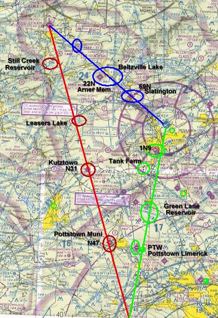
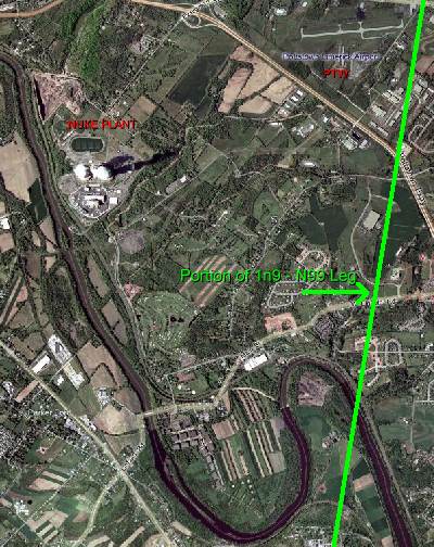
I try to compare the sectional to the Windows Live Local. Take a look at the third leg (green) from ABE to N99. I pass just East of PTW and just past the eastern bend in the river.
I also complete my nav log with all the leg times, fuel burns and weight and balance. My CFI provided a nice Nav Log worksheet and I recreated it on excel. I also added a 1-800-WX-Brief work sheet that makes life easier while taking down all the info FSS provides. I posted a copy of this in case anyone finds it usefull.
Time to fly the XC flight on flight sim just to get a feel for the navigation and landmarks. I punch in the winds aloft to try and check my times vs my nav log, it helps.
If the winds calm down I may get up for some T&G's tomorrow but it's not looking good. I hope to get some flying time in this week!! For now, back to the books !!
No comments:
Post a Comment